 Parler
 Gab
Gab
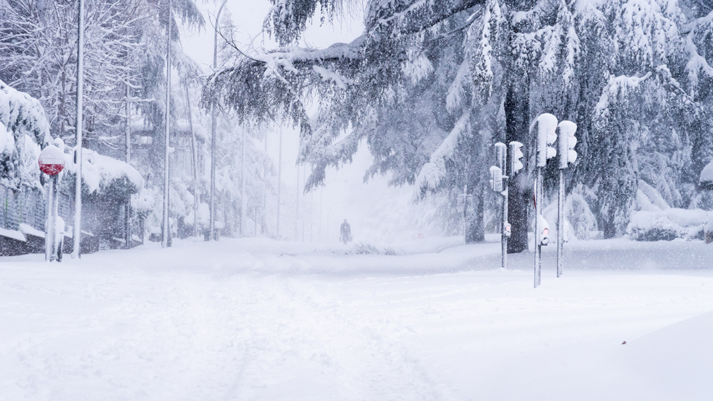
- A polar vortex is set to bring life-threatening cold, heavy snowfall and widespread disruptions to the eastern half of the United States, with some areas experiencing the most severe winter weather in decades.
- The Hudson Valley and surrounding regions faced 4 to 8 inches of snow, with hazardous travel conditions and temperatures plummeting into the single digits. A second storm system will bring additional snowfall, creating challenging travel conditions in states like North Carolina, Virginia and the Delmarva Peninsula.
- Cities such as Houston, New Orleans and Charleston are preparing for up to half a foot of snow, potentially the biggest snowstorm on record in parts of the Deep South, with major traffic and travel disruptions expected.
- Sub-zero wind chills and temperatures well below average are forecast for the Plains, Upper Midwest, Ohio and Tennessee Valleys, with risks of hypothermia and frostbite, and potential impacts on infrastructure, especially in the South.
- The current Arctic outbreak is similar to the 2013-2014 polar vortex event, though possibly shorter-lived. Research is ongoing to understand the role of climate change in increasing the frequency of such extreme weather events.
Historic snowstorm targets the Northeast
The week began with a winter storm warning for the Hudson Valley and surrounding regions, where 4 to 8 inches of powdery snow fell between Sunday afternoon and early Monday. Meteorologist Ben Noll described the event as a "good, old-fashioned snowstorm," with snowfall rates reaching up to an inch per hour during the evening. "Roads and sidewalks will become snow-covered, making travel treacherous," Noll warned. Temperatures plummeted into the single digits as the storm departed, creating hazardous conditions for residents. The Northeast is not alone in facing severe winter weather. A second storm system is expected to sweep across the eastern U.S. later this week, bringing light to moderate snowfall to the region. While the storm is not expected to be highly organized, it will create challenging travel conditions, particularly in areas like North Carolina, Virginia and the Delmarva Peninsula, where frozen precipitation is less common.Deep South braces for rare snowfall
Meanwhile, the Deep South is preparing for an unprecedented winter event. A rare snowstorm is forecast to hit cities like Houston, New Orleans and Charleston, with some areas potentially receiving up to half a foot of snow. "This could be the biggest snowstorm on record in parts of the Deep South," Noll noted. The National Weather Service (NWS) has urged residents to exercise extreme caution, warning of major traffic and travel disruptions. In New Orleans, where 2 to 3 inches of snow are expected, the NWS advised, "Exercise extreme caution if travel cannot be avoided." Similarly, Baton Rouge could see 4 to 6 inches of snow, while Houston may receive up to 5 inches in some areas. The storm is expected to grind travel to a halt in regions unaccustomed to such wintry conditions.Life-threatening cold grips the nation
The snowstorms are just the beginning of a broader Arctic outbreak tied to the polar vortex. Frigid air is sweeping southward from the Plains and Ohio Valley, bringing sub-zero wind chills and temperatures well below average. "This will be the coldest air of the winter season thus far, and in many cases the coldest in several years," the NWS warned. Life-threatening wind chills as low as minus-55°F are forecast for the Plains and Upper Midwest, with similar conditions expected in the Ohio and Tennessee Valleys. The cold will also spread into the Mid-Atlantic and Northeast, where temperatures in cities like New York and Washington, D.C., are expected to drop into the teens. The Arctic blast poses significant risks to public health, with the NWS highlighting the dangers of hypothermia and frostbite for those exposed to the cold. Infrastructure, including water and power systems, is also at risk, particularly in the South, where such extreme cold is rare.A winter to remember
This week's weather is reminiscent of the infamous polar vortex winter of 2013-2014, though meteorologists believe the current event may be shorter-lived. Judah Cohen, a meteorologist at Atmospheric & Environmental Research, explained that the polar vortex is currently "stretched" from north to south, allowing Arctic air to surge into the continental U.S. While the immediate focus is on the cold and snow, the long-term implications of polar vortex shifts remain an area of active research. Some studies suggest that human-caused climate change may increase the likelihood of such events, though the science is still evolving. For now, millions of Americans are bracing for a week of extreme winter weather. As Noll succinctly put it, "Spring is just… two months away." Until then, the nation must endure one of the coldest and snowiest periods in recent memory. Sources include: ZeroHedge.com FoxWeather.com Axios.comChina’s hypersonic air-to-air missile: A game-changer in modern warfare
By Lance D Johnson // Share
California’s liberal leadership fails as wildfires rage and fire trucks sit idle
By Willow Tohi // Share
5 super creepy new technologies that should chill all of us to the core
By News Editors // Share
Russian forces seize Velyka Novosilka, exposing Ukraine’s manpower crisis
By Cassie B. // Share
“Off Grid Survival Skills” Episode 3: The hidden herbs and superfoods in your backyard
By Jacob Thomas // Share
Governments continue to obscure COVID-19 vaccine data amid rising concerns over excess deaths
By patricklewis // Share
Tech giant Microsoft backs EXTINCTION with its support of carbon capture programs
By ramontomeydw // Share
Germany to resume arms exports to Israel despite repeated ceasefire violations
By isabelle // Share


